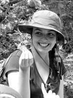
Martin Béland
Membre régulier
Lidar et relations structure 3D-fonctions des forêts
Université Laval
Faculté de Foresterie et Géomatique
Département des sciences géomatiques
Pavillon Louis-Jacques-Casault
1055, avenue du Séminaire, local 1325
Université Laval
Québec (Québec) Canada, G1V 0A6
(418)-656-2131, poste 404611
FORMATION
- Chercheur postdoctoral - Laboratoire de biométéorologie, Department of Environmental Science, Policy and Management (Université de Californie, Berkeley)
- Doctorat en télédétection - cheminement interdisciplinaire en environnement (Université de Sherbrooke)
- Maitrise en environnement (Université de Sherbrooke)
- Baccalauréat en géomatique (Université Laval)
THÈMES DE RECHERCHE
- Utilisation du lidar terrestre pour estimer les paramètres structuraux des arbres à l’échelle de la parcelle, p.ex., distribution 3D de la surface foliaire (leaf area), agrégation du feuillage (foliage clumping) et architecture des couronnes.
- Utilisation du lidar aéroporté pour cartographier le volume de bois pour les fins d’aménagement forestier
- Simulation des interactions entre l'énergie solaire et les forêts afin d'améliorer l'interprétation des image satellitaires, en particulier la cartographie des variables climatiques essentielles comme l'indice de surface foliaire (LAI) et la composition biochimique du feuillage.
- Simulation des interactions entre l'environnement (éclairement solaire, carbone atmosphérique, vents, température, humidité de l'air) et le fonctionnement des forêts (photosynthèse, évapotranspiration) par modélisation biophysique afin de mieux définir les relations entre structure 3D et fonctions pour différents types de forêts.
PUBLICATIONS
Livres
Aucun
Chapitres de livre
Aucun
Livres, numéros spéciaux et actes de colloques publiés à titre d'éditeur
Aucun
Articles révisés par un comité de lecture
- Montalban, K., Moszkowicz, T., St-Denis, A., Messier, C., Beland, M. (2026) Exploring the impact of ice storm on urban forests and branch fall using mobile LiDAR. Urban Forestry & Urban Greening, 116:129223
- Beland, M. (2025) Mapping wood area in forests from ground lidar and estimating their light interception using radiative transfer modeling. Agricultural and Forest Meteorology, 375:110883
- Perbet, P., Guindon, L., Cote, J.-F., Beland, M. (2025) Evaluating landsat time series of above-ground biomass to monitor boreal forest recovery following different types of disturbance. Canadian Journal of Remote Sensing, 51(1):2587489
- Perbet, P., Guindon, L., Correia, D.L.P., Gahrouei, O.R., Cote, J.-F., Beland, M. (2025) Historical insect disturbance maps from 1985 onwards for Canadian forests derived using earth observation data. Scientific Data, 12(1):1-14
- Beland, M., Kobayashi, H. (2024) Drivers of deciduous forest near-infrared reflectance: A 3D radiative transfer modeling exercise based on ground lidar. Remote Sensing of Environment, 302:113951
- Perbet, P., Guindon, L., Cote, J.-F., Beland, M. (2024) Evaluating deep learning methods applied to Landsat time series subsequences to detect and classify boreal forest disturbances events: The challenge of partial and progressive disturbances. Remote Sensing of Environment, 306:114107
- Omid Reisi Gahrouei Jean-Francois Cote, P.B.P.G., Beland, M. (2024) Comparison of Deep and Machine Learning Approaches for Quebec Tree Species Classification Using a Combination of Multispectral and LiDAR Data. Canadian Journal of Remote Sensing, 50(1):2359433
- Reyes-Consuelo, M.A., Kiss, J., Edwards, G., Beland, M. (2024) EEG-Based Affective Responses to Immersion in a Virtual Forest. The International Journal of Health, Wellness, and Society, 14(4):21-50
- Yi, K., Novick, K.A., Zhang, Q., Wang, L., Hwang, T., Yang, X., Mallick, K., Beland, M., Senay, G.B., Baldocchi, D.D. (2024) Responses of Marginal and Intrinsic Water-Use Efficiency to Changing Aridity Using FLUXNET Observations. Journal of Geophysical Research: Biogeosciences, 129(6)
- Beland, M., Kobayashi, H. (2021) Mapping forest leaf area density from multiview terrestrial lidar. Methods in Ecology and Evolution, 12(4):619-633
- Beland, M., Baldocchi, D.D. (2021) Vertical structure heterogeneity in broadleaf forests: Effects on light interception and canopy photosynthesis. Agricultural and Forest Meteorology, 307
- Beland, M., Baldocchi, D.D. (2021) Erratum to “Vertical structure heterogeneity in broadleaf forests: Effects on light interception and canopy photosynthesis” (Agricultural and Forest Meteorology (2021) 307, (108525), (S0168192321002094), (10.1016/j.agrformet.2021.108525)). Agricultural and Forest Meteorology
- Beland, M., Baldocchi, D. (2020) Is foliage clumping an outcome of resource limitations within forests? Agricultural and Forest Meteorology, 295
- Tremblay, J.-F., Beland, M., Gagnon, R., Pomerleau, F., Giguère, P. (2020) Automatic three-dimensional mapping for tree diameter measurements in inventory operations. Journal of Field Robotics, 37(8):1328-1346
- Beland, M., Parker, G., Sparrow, B., Harding, D., Chasmer, L., Phinn, S., Antonarakis, A., Strahler, A. (2019) On promoting the use of lidar systems in forest ecosystem research. Forest Ecology and Management, 450
- Perbet, P., Fortin, M., Ville, A., Beland, M. (2019) Near real-time deforestation detection in Malaysia and Indonesia using change vector analysis with three sensors. International Journal of Remote Sensing, 40(19):7439-7458
- Tremblay, J.-F., Beland, M. (2018) Towards operational marker-free registration of terrestrial lidar data in forests. ISPRS Journal of Photogrammetry and Remote Sensing, 146:430 - 435
- Roussel, J.-R., Beland, M., Caspersen, J., Achim, A. (2018) A mathematical framework to describe the effect of beam incidence angle on metrics derived from airborne LiDAR: The case of forest canopies approaching turbid medium behaviour. Remote Sensing of Environment, 209:824 – 834
- Roussel, J.-R., Caspersen, J., Beland, M., Thomas, S., Achim, A. (2017) Removing bias from LiDAR-based estimates of canopy height: Accounting for the effects of pulse density and footprint size. Remote Sensing of Environment, 198:1 - 16
- Beland, M., Baldocchi, D.D., Widlowski, J.-L., Fournier, R.A., Verstraete, M.M. (2014) On seeing the wood from the leaves and the role of voxel size in determining leaf area distribution of forests with terrestrial LiDAR. Agricultural and Forest Meteorology, 184:82-97
- Widlowski, J.-L., Cote, J.-F., Beland, M. (2014) Abstract tree crowns in 3D radiative transfer models: Impact on simulated open-canopy reflectances. Remote Sensing of Environment, 142:155-175
- Beland, M., Widlowski, J.-L., Fournier, R.A. (2014) A model for deriving voxel-level tree leaf area density estimates from ground-based LiDAR. Environmental Modelling and Software, 51:184 - 189
- Verheijen, F.G.A., Jeffery, S., Van Der Velde, M., Penizek, V., Beland, M., Bastos, A.C., Keizer, J.J. (2013) Reductions in soil surface albedo as a function of biochar application rate: Implications for global radiative forcing. Environmental Research Letters, 8(4)
- Beland, M., Widlowski, J.-L., Fournier, R.A., Cote, J.-F., Verstraete, M.M. (2011) Estimating leaf area distribution in savanna trees from terrestrial LiDAR measurements. Agricultural and Forest Meteorology, 151(9):1252-1266
- Beland, M., Goita, K., Bonn, F., Pham, T.-T.-H. (2006) Assessment of land-cover changes related to shrimp aquaculture using remote sensing data: A case study in the Giao Thuy District, Vietnam. International Journal of Remote Sensing, 27(8):1491-1510
Articles publiés dans des actes de colloque (proceedings)
- Fournier, R.A., Cote, J.-F., Bourge, F., Durrieu, S., Piboule, A., Beland, M. (2015) A method addressing signal occlusion by scene objects to quantify the 3D distribution of forest components from terrestrial lidar. In SilviLaser 2015. La Grande Motte, France, September, pages 29-31
- Kim, A.M., Olsen, R.C., Beland, M. (2015) Simulation of small footprint full waveform LIDAR propagation through a tree canopy in 3D.
- Beland, M., Fournier, R.A. (2008) Extracting savanna tree structure parameters from multiangular remote sensing. In International Geoscience and Remote Sensing Symposium (IGARSS). --
Rapports scientifiques, manuels et autres
- Beland, M., Parker, G., Harding, D., Hopkinson, C., Chasmer, L., Antonarakis, A. (2015) White Paper – On the Use of LiDAR Data at AmeriFlux Sites. Technical report, AmeriFlux
Thèses, mémoires et essais
- Beland, M. (2011) Estimation de paramètres structuraux des arbres dans une savane à partir de mesures LiDAR terrestre et d'imagerie à très haute résolution spatiale. Thèse de doctorat, Université de Sherbrooke
Thèses, mémoires et essais supervisés
- Reyes Consuelo, M. A. (2023) Une forêt de réalité virtuelle pour la réduction du stress physiologique chez les personnes sans troubles neurodégénératifs. Mémoire de maîtrise, Université Laval
- Shaker, M. (2022) Utilisation de données LiDAR terrestres pour créer une forêt virtuelle dans Unreal Engine 4 afin de réduire le niveau d'anxiété des patients atteints de la maladie d'Alzheimer. Thèse de doctorat, Université Laval
- Matte, O. (2020) Cartographie des forêts à haute valeur de stockage de carbone par apprentissage profond sur l’île de Bornéo. Thèse de doctorat, Université Laval
- Tremblay, J.-F. (2019) Forest inventory with a lidar-equipped robot for difficult environments. Mémoire de maîtrise, Université Laval
- Perbet, P. (2019) Système d'alerte dynamique par télédétection pour l'observation des déforestations en Malaisie. Thèse de doctorat, Université Laval
- Roussel, J.-R. (2018) Quantification théorique des effets du paramétrage du système d'acquisition sur les variables descriptives du nuage de points LiDAR. Thèse de doctorat, Université Laval
Articles non révisés par un comité de lecture
Aucun
<< Jean-Michel Beaudoin | MembresReguliers | Nicolas Bélanger >>


