Daniela Mazo Calle
Maîtrise
Effets des pratiques d’organisation spatiale de la récolte forestière sur la performance financière via une approche de benchmarking.
Université du Québec en Abitibi-Témiscamingue
Directeur: Osvaldo Valeria
Désolé mais l'information
c'est dans anglais
About me
My name is Daniela Mazo, I was born in Medellín, Colombia. I’m a forestry engineer of the National University of Colombia, after my degree, I started working as GIS analyst, that’s how I get interested in spatial analysis. After 3 years of a lot of learning my curiosity begins to rise and I need it to find a new challenge in my life, a master degree in Canada seems the perfect opportunity to learn of one of the leaders in forest management and to try to understand more about the implications of the spatial component in ecosystems.
Formation
- (2008/02 - 2014/09) B.Sc.Forest Engineer. National University (Environmental Sciences), Colombia, Medellin
Training and workshops
- Carnegie Institution for Science - Department of Global Ecology. Virtual Course CLASlite Forest Monitoring Technology (2016)
- The National University of Colombia. Advanced ArcGis (2013).
Seminars
- 5th Forestry Symposium (2012), Medellin, Colombia.
- International Symposium Ecological restoration: challenges and strategies of restoration in the Colombian Caribbean, (2012), Barranquilla, Colombia.
Professional experience
- (2016/04 - Now) Remote Sensing and GIS Expert, South Pole, Colombia https://www.southpole.com/
 . Assistant in the evaluation of carbon projects in several places in the world using remote sensing images.
- (2014/11 - 2015/12) Georeferencer, Municipality of Medellin - Property Unit, Colombia
- (2014/01 - 2014/06) Intern, Intercolombia - ISA, Colombia. Development of a forestry inventory in the company's headquarters (Medellin).Production of technical reports for the Government of Colombia. Production of technical reports on vegetation.
- (2013-02 - 2013-06) Field auxiliary, Amacayacu project, Amazonas, Colombia https://forestgeo.si.edu/sites/neotropics/amacayacu
 Recollection of field data. Processing of information and production of technical reports.
Project:
EFFECTS OF SPATIAL FOREST HARVESTING PRACTICES ON FINANCIAL PERFORMANCE THROUGH A BENCHMARKING APPROACH
keywords: DEA, spatial index, roads, efficiency
Forest harvesting in the first element of the wood supply chain for the industry of paper and manufacture and it's itself an industry. Performance in forest harvesting is an important factor that is forcing the industry and the government of Quebec to find solutions to improve it, with a special interest in forestry roads and transport of the wood. With the application of the ecosystem forest management the harvesting is performed depending on the natural perturbation characteristic of each forest ecosystem (bioclimatic domains), this will create different spatial patrons of the harvested blocks that will have an effect on the cost in extracting the wood.
The objective is to compare the dominant forest management strategies in the bioclimatic domains in western Quebec based on a benchmarking method of financial performance call Data envelopment analysis - DEA. The forest management strategies will be described in terms of spatial variables such as the size area, shape of harvested stands and dispersion of harvested stands, and non-spatial variables of forest management such as harvest practices (partial cut or clear-cutting) and volume harvested per species, and other variables associated with the forest sector such as construction and maintenance costs of roads. The financial performance of the management regime will be evaluated according to the wood procurement cost of each cubic meter.
The expected results of the research are to understand the influence of the spatial variables in the performance of the harvest activity. Establish the practices that have better results on producing wood at a lower cost and currently being carried out.
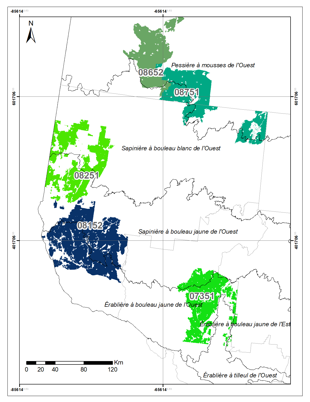
For doing this we have created a database of 84 harvested stands in the west of Quebec, and cover 4 bioclimatic domains, from spruce-moss, balsam fir, and sugar maples in a north-south gradient. The database has spatial variables that characterized the harvested blocks configuration and management variables as wood procurement cost, type of silvicultural treatment, taxes for a total of 28 variables. Several statistic analysis will be performed to choose the variables
Map: Location of harvested stands


